


Scout To Hunt: Shed Hunt Maps app for iPhone and iPad
Developer: Darren Labrum
First release : 10 Dec 2017
App size: 119.92 Mb
THE SHED HUNTERS APP
Uncomplicated Offline 3D Maps and features built for the Shedicated shed hunter.
Maximize every hour and every mile of your search for brown gold by leveraging the shed antlers you have already found to gain exclusive shed hunting insights. With the Scout To Hunt App you can create a dynamic and personal shed-finding tool that is powered only by you while in pursuit of heavier packs and bigger stacks.
Master the art of the shed hunt as you use the Scout To Hunt App to organize your shed hunting data into private stats that reveal the complete story that your shed antlers are telling you and let them lead you to your next pile. Track your success to illuminate your way to the next bone zone and learn from your past pick-ups to make the most of every shed run.
TRUST IS ENCRYPTED
Scout To Hunt is the only hunting app focused on protecting your hunting data, keeping it visible only to you and those you voluntarily share it with. You control your hard-earned map and location data when you scout and hunt with the Scout To Hunt App. We have taken the additional step to ensure that all your information is secured through the AES-256 encryption-key methodology, an unbroken encryption algorithm. Your data is encrypted when stored and transmitted.
Map and location data you create are only accessible and viewable by the account holder (you). When you place and share a Marker or record a Track, for example, the GPS location information becomes encrypted, hidden from anyone who does not have user-provided access to it – including Scout To Hunt. Its your data, and we keep it that way.
GET SHEDICATED!
Shedicated - Yearly subscription to access Offline 3D Maps and advanced features and map layers for the Shedicated shed hunter - 29.99/year
HuntReady Offline 3D Maps™
• High-resolution full-scale immersive 3D/2D perspective – no matter where your hunt takes you.
• Living Map Automation - HuntReady Offline Maps™ autonomously stay up-to-date and maintain reliability and accuracy, even after being saved. Download it only once, and its good forever.
Advanced Map Layers - Elevation Bands, South Slopes, Vegetation, and more
UnPaved™ Off-Roads & Trails - 1.5 Million+ miles of Off-Roads and Trails. The most comprehensive off-roads system for the western shed hunter
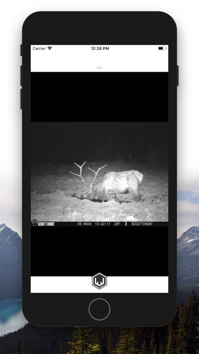
Matched Sets - Link and track all of your matched sides on your map
FREE ESSENTIAL MAP FEATURES
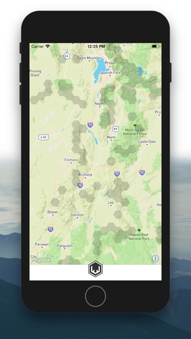
Online 3D/2D Base Maps - High-resolution maps that allow you to gain the perspective you want
• Hybrid - 24k Topo visually refined contours for easy reading and interpretation seamlessly merged with our Sat base map
• Sat - High-resolution satellite and aerial imagery for exceptional terrain detail and map performance
• Topo - 24k topographic map processed from the leading elevation and land cover sources, verified by 24 datasets from 13 different organizations, including the USGS
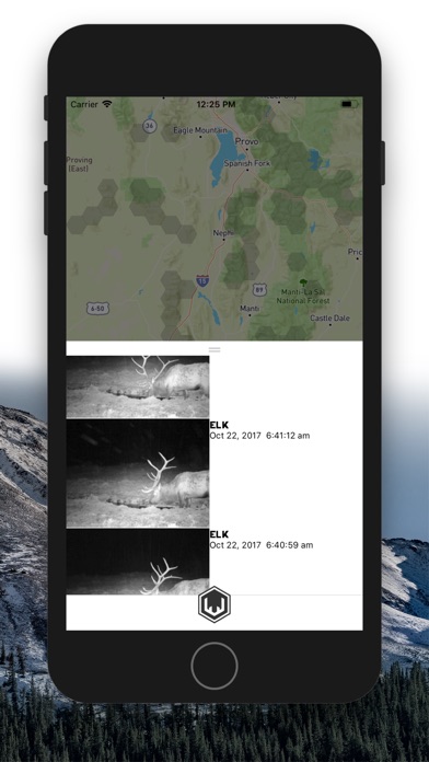
Tracks - Track your hikes while tracking the stats that matter: Sheds per Mile, Elevation, Distance, Duration, and more
90 Custom Markers with 10 color options - Simply Press and Hold down on your map to place a location Marker
Off-Grid Sharing: rapidly share your Markers locally, even when youre offline and out of signal
Comprehensive Hunt Units (GMUs) - No single-state restrictions
Visually Optimized Layers - Including Private landowner information, Public land boundaries, Game Ranges, and more
Universal Device Syncing - Sync Across all of your mobile devices
SUBSCRIPTION MANAGEMENT
•Subscription automatically renews unless auto-renew is turned off at least 24 hours before the end of the current period.
•Your iTunes account will be charged for renewal within 24 hours before the end of the current period.
TERMS OF USE
https://www.scouttohunt.com/terms-of-use/